Site details
Galatas: Psathi
| PK | C5763 |
| TITLE | Galatas: Psathi |
| WGS84 | 35.513053° N, 23.95754° E |
| Accuracy | Exact |
| LAT/LON | 35.513053, 23.95754 |
| LON/LAT | 23.95754, 35.513053 |
| DMS | 35° 30' 46.9908" N | , | 23° 57' 27.144" E |
| W3W | fezzes, thatched, educate |
| UTM | 34 S, 768224, 3933965 |
| EGSA87 | 496001, 3929653 |
| Elevation m | 16 |
| Elevation feet | 52.5 |
| Region | Crete |
| Subregion | Kydhonia |
GENERAL SITE TYPE Settlement
TYPE
1. hab. Moody [1987], 'The site was evidently a fair-sized habitation.'2. Settlement. Hood [1965], 108 'Settlement with traces of occupation in M.M. I or earlier...'
PERIOD (High Chronology)
1. Early Minoan: (3100 BC - 2200 BC)
a. Moody [1987]: , 'EM/MMI egg cup bases, ...'
2. Early Minoan II: (2650 BC - 2200 BC)
a. Hood [1965]: 108, 'All (sherds, RHC) may therefore be of the period from E.M. II to M.M. I, ...'
3. Middle Minoan I: (2100 BC - 1900 BC)
a. Hood [1965]: 108, '... traces of occupation in M.M. I or earlier...'
b. Moody [1987]: , 'EM/MMI egg cup bases, ...'
NOTES
1. Bluff identified from the photo in Hood [1965], Plate 22.
2. Moody [1987] says: '.6 km W of Kalamaki beach. Overlooking the E end of the Stalos and Aghia Marina beach.'
3. A blog post that discusses the locational issues is here.
rhc
BIBLIOGRAPHY
1. Hood [1965]: Hood, M.S.F.. ‘Minoan Sites in the Far West of Crete’, The Annual of the British School at Athens (60), pp. 99-113, 1965., 'C. 6. Galatas; 1. 'Psathi'', pg. 108.
Online here.
2. Moody [1987]: Moody, Jennifer Alice. The Environmental and Cultural Prehistory of the Khania Region of West Crete: Neolithic through Late Minoan III. Ph.D. Dissertation. The Graduate School of the University of Minnesota. 1987., 'GA1; Kydonia: Galatis: Kato Stalos: Psathi', Online here.
PHOTOS AND IMAGES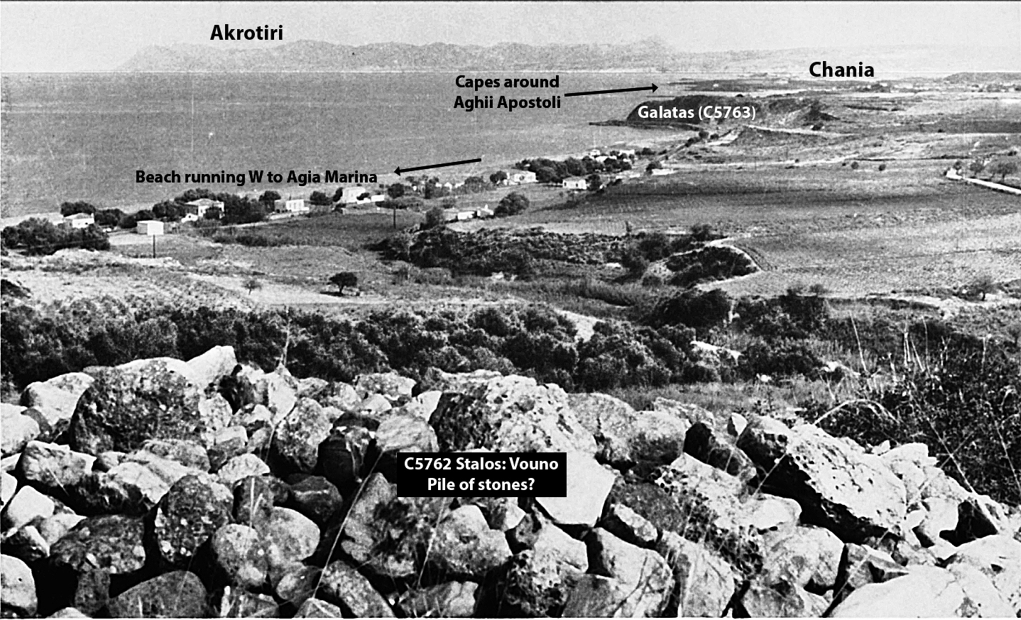
Cape Galatas, NW Crete, ca. 1965.
Photo created by M.S.F. Hood and labeled by R. Consoli